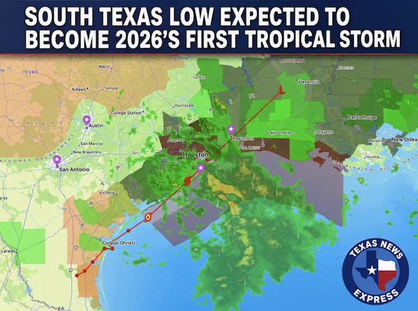
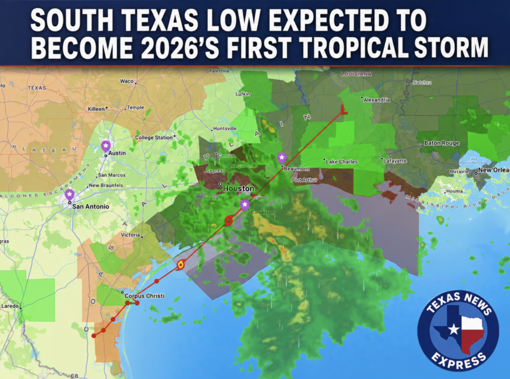
A low-pressure system moving along the Texas Gulf Coast could become the first named storm of the 2026 Atlantic hurricane season, but for Houston and surrounding communities, the greatest danger is already unfolding: repeated heavy rain falling on saturated ground.
The National Hurricane Center designated the disturbance Potential Tropical Cyclone One as it moved northeastward along the middle Texas coast Wednesday. The system had sustained winds of about 30 mph and was expected to track along the coast before moving inland over southwestern Louisiana Wednesday night.
Forecasters said the system could briefly strengthen into a tropical storm before landfall. If it reaches sustained winds of at least 39 mph, it will be named Tropical Storm Arthur.
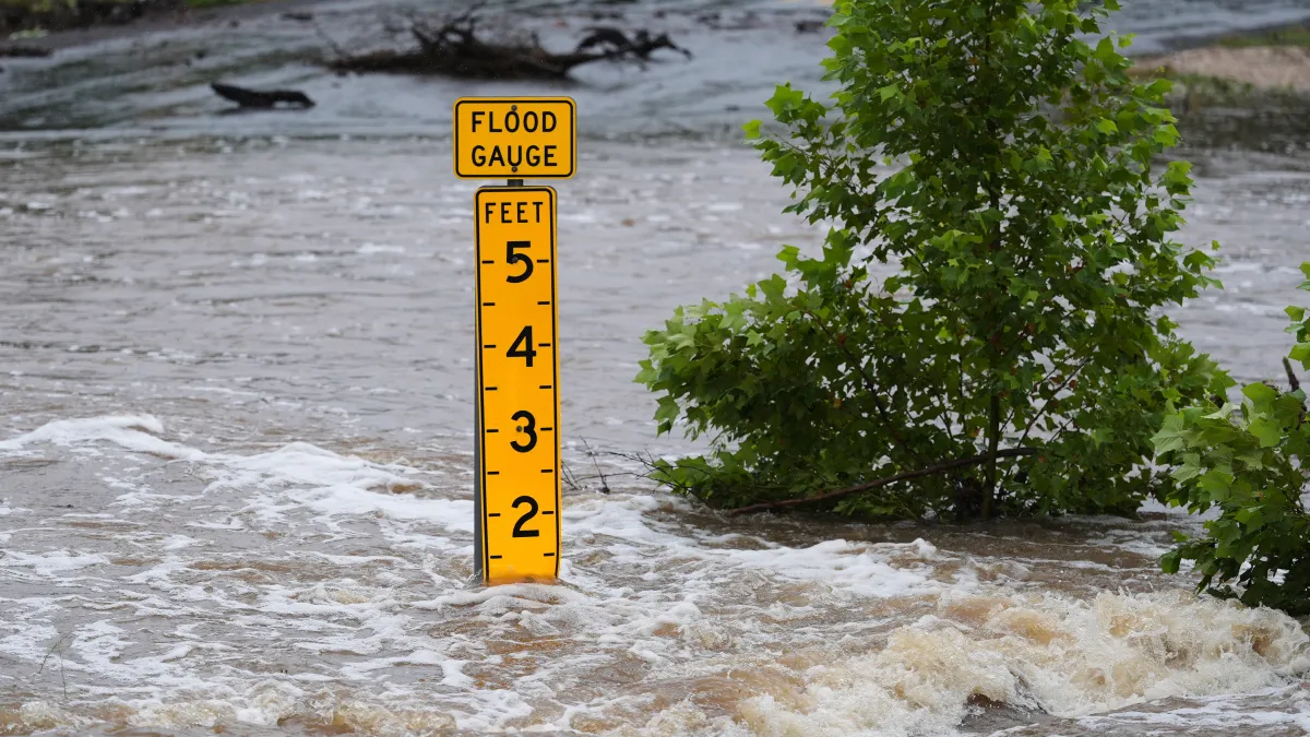
Whether the system earns a name, however, is unlikely to make much difference for most Houston-area residents. Meteorologists say the primary threat is heavy rainfall capable of causing flash flooding, street flooding and rising water along creeks, bayous and rivers.
A flood watch remains in effect across much of Southeast Texas, including Harris, Fort Bend, Montgomery, Galveston, Brazoria, Chambers, Liberty, Wharton and Matagorda counties. The most serious flooding threat is expected through Wednesday afternoon, with conditions gradually improving from west to east Wednesday evening.
Some parts of Southeast Texas have already received several inches of rain. Flash flood warnings were issued Wednesday morning for portions of Harris, Chambers, Liberty and Brazoria counties.
Areas including Pasadena, Baytown, La Porte, Deer Park, Channelview, Crosby, Kingwood and nearby communities faced the potential for rainfall rates of 2 to 4 inches per hour. In southeastern Brazoria County, between 5 and nearly 8 inches of rain had reportedly fallen since midnight, producing dangerous flooding near Freeport, Clute, Surfside Beach and eastern Angleton.
Additional rainfall of 2 to 4 inches is possible across much of the Houston region, with locally higher totals near the coast. The National Hurricane Center said the broader storm system could produce totals of 5 to 10 inches from the middle and upper Texas coast eastward, with isolated amounts approaching 20 inches across parts of the southern United States.
The wide range reflects the uneven nature of tropical rainfall. One neighborhood may receive moderate rain while another only a few miles away experiences a prolonged downpour. That makes it difficult to predict exactly which streets or watersheds will flood.
Coastal communities face additional hazards. A tropical storm watch extends from Sargent to Sabine Pass, covering Galveston Island, Galveston Bay, the Bolivar Peninsula, Chambers County and coastal parts of Brazoria and Galveston counties.
Brief tropical-storm-force wind gusts are possible near the coast, although widespread damaging winds are not currently expected across most of metropolitan Houston. Persistent onshore winds could push water inland, producing coastal flooding around Galveston Bay, Bolivar Peninsula and other low-lying shorelines.
The National Hurricane Center said storm surge could reach 2 to 4 feet above normally dry ground between Port Bolivar and Morgan City, Louisiana, depending on the storm’s track and the timing of high tide.
A few short-lived tornadoes are also possible along the upper Texas coast and farther east into Louisiana and Mississippi. Tropical systems can produce small tornadoes that form quickly and provide relatively little warning.
Houston officials began preparing before the heaviest rain arrived. Mayor John Whitmire ordered Lake Houston lowered to create additional capacity for runoff. The city placed barricades near flood-prone roads and prepared high-water vehicles for possible rescues.
CenterPoint Energy also activated its emergency operations center and mobilized about 2,600 workers to respond to possible electricity and natural-gas emergencies. Gov. Greg Abbott issued a disaster declaration covering dozens of counties, including Harris County.
The storm is also affecting Houston during World Cup events. Officials have continued preparations for Wednesday’s match between Portugal and the Democratic Republic of the Congo. The stadium is covered, but rain and flooding could affect traffic, public transportation and outdoor activities surrounding the game.
The worst conditions in the Houston area are expected through Wednesday morning and early afternoon. Rain should gradually shift east later Wednesday as the system moves toward the Texas-Louisiana border.
Forecasters caution that the improving forecast does not mean every flooding problem will disappear immediately. Water can continue rising in bayous, creeks and rivers after the heaviest rain ends, particularly where repeated storms have already saturated the ground.
Residents are being urged to avoid unnecessary travel during heavy rain and never drive around barricades or into standing water. Houston’s flood risk is often greatest on underpasses, frontage roads and streets near bayous, where water can rise quickly and appear shallower than it is.
For Houston, this is not currently forecast to be a major wind-driven tropical storm. It is primarily a water event — and in a region where flooding can become dangerous within minutes, the storm’s name may matter far less than where its heaviest rain falls.