A cold front moving across Texas on Sunday, May 10, 2026, is expected to bring another round of strong to severe thunderstorms to parts of the state, with the highest concern focused on North Texas and Central Texas before storms move toward the Houston area overnight. The main threats include damaging straight-line winds, large hail and locally heavy rainfall, while an isolated tornado cannot be ruled out in some areas.
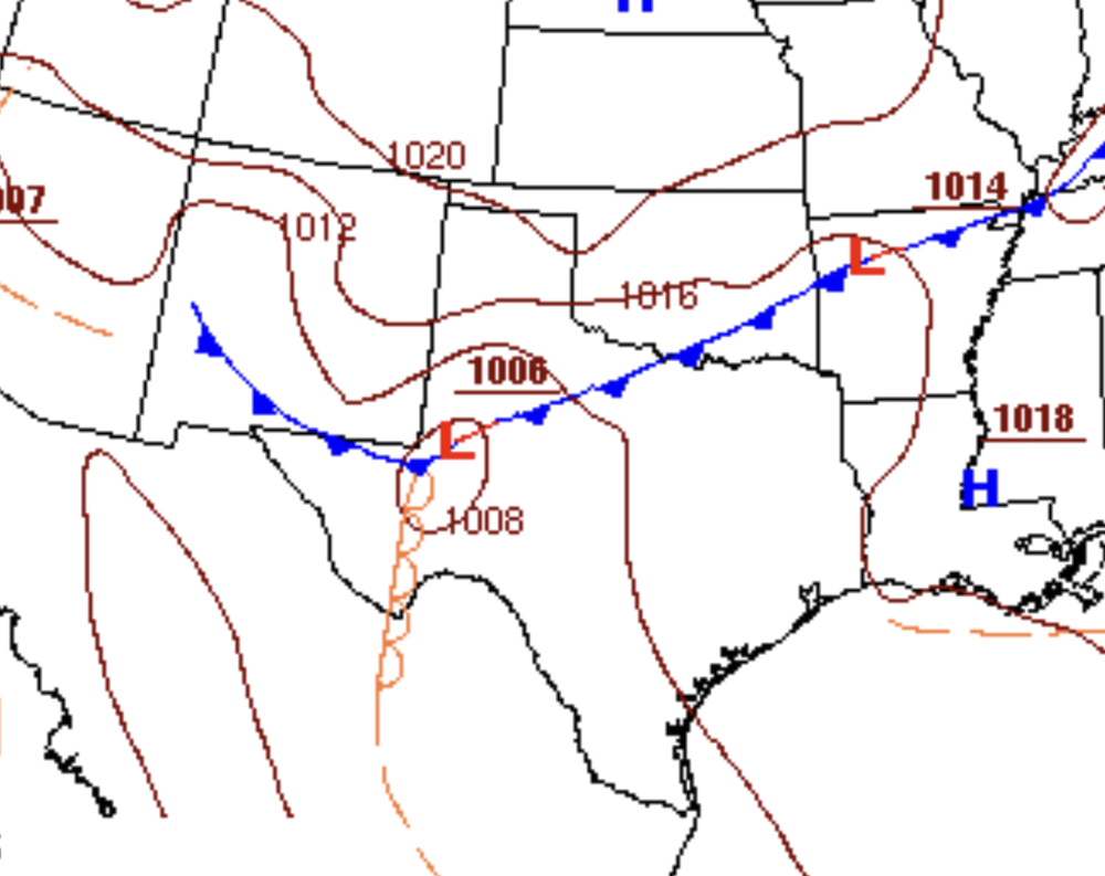
Weather Map as it passes through the DFW Metroplex Sunday afternoon.
In the Dallas-Fort Worth area, storms are expected to be possible from the afternoon through late evening. CBS Texas reported that storms could affect North Texas from about 2 p.m. to midnight, with a late-afternoon storm complex increasing the damaging-wind threat. The Storm Prediction Center placed parts of North Texas under an Enhanced Risk, Level 3 out of 5, where hail of 2 inches or larger and wind gusts around hurricane strength may be possible.
The National Weather Service office for Fort Worth/Dallas said scattered to numerous storms were expected as the cold front pushed through the region, with the severe threat increasing during the afternoon and evening. The agency listed large hail and damaging winds as the main hazards and warned that slow-moving or training storms could produce locally heavy rain totals of 2 to 4 inches in some locations.
In the Austin area, the severe-weather threat is expected to arrive later Sunday evening and continue into early Monday morning. The National Weather Service Au
stin/San Antonio office said the northern Hill Country and northern I-35 corridor, including Georgetown and Burnet, are under an Enhanced Risk, Level 3 out of 5, while Austin and San Antonio are under a Slight Risk, Level 2 out of 5. The main concerns are damaging wind gusts, large hail and heavy rainfall as a line of storms moves across the region.
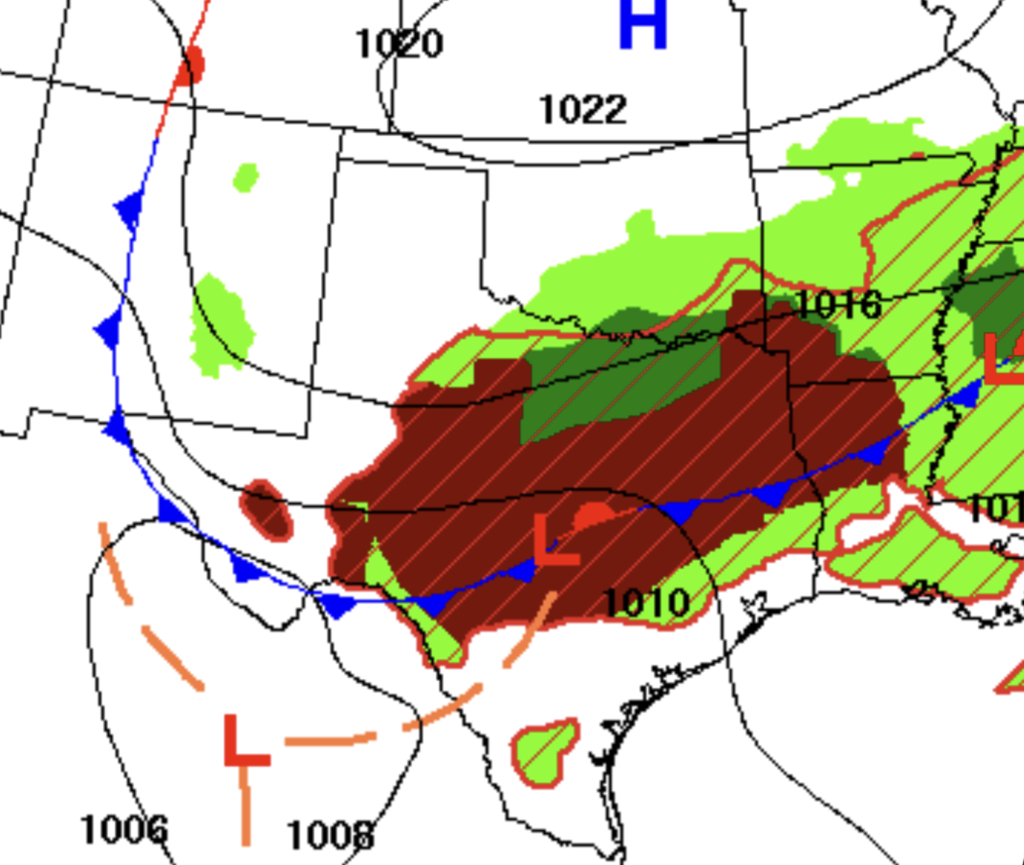
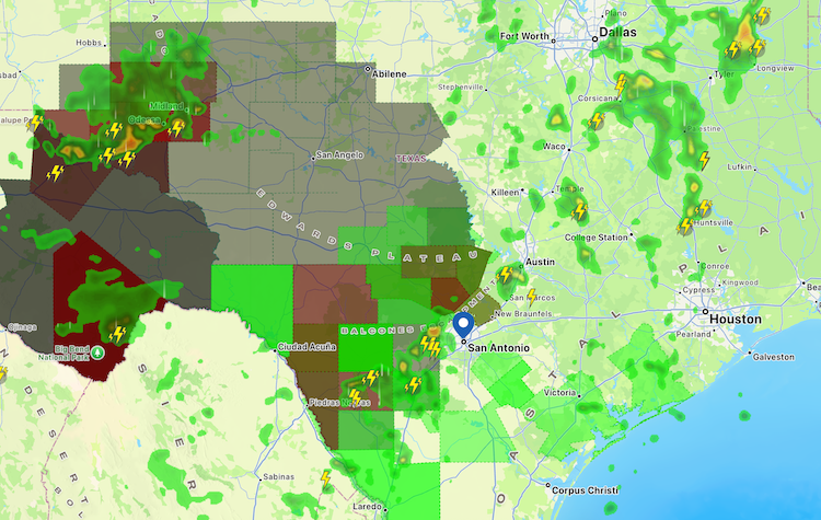
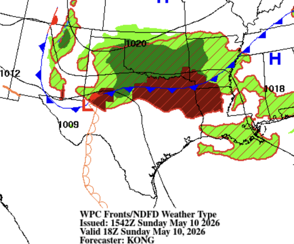
Weather map as the cold front and storms approach Austin and Houston.
For Austin, storms could reach parts of Travis, Williamson and Hays counties as early as 6 p.m., though they are more likely to affect the Austin area after dark. NWS timing guidance for South-Central Texas places the most likely storm window for the I-35 corridor around 10 p.m. Sunday to 1 a.m. Monday, with storms expected to move south of the region by Monday morning.
The Houston area is expected to see the threat later, mainly late Sunday night into early Monday morning. Chron reported that the National Weather Service Houston-Galveston office expected a slight chance of storms before 1 a.m., followed by a more likely storm window between 1 a.m. and 4 a.m. Monday. Houston’s storm risk is lower than North and Central Texas, but storms may still bring damaging winds, large hail and possibly an isolated tornado.
The Houston forecast calls for warm and humid conditions ahead of the front, with Sunday highs near 90°F and a low near 71°F overnight. Monday is expected to be cooler, with a high near 85°F and scattered thunderstorms still possible in parts of the area. Dallas is expected to reach the low 80s Sunday with severe storms mainly later in the day, while Austin is expected to be very warm, with highs in the low 90s before the front arrives.
Residents in all three metro areas should have multiple ways to receive warnings overnight, especially because parts of the Houston and Austin storm threat may occur while many people are sleeping. The National Weather Service recommends staying weather-aware through smartphones, local media, NOAA Weather Radio and other alert systems, and moving indoors quickly if warnings are issued.
Expected timing by metro area
| Metro area | Most likely storm window | Main threats |
|---|---|---|
| Dallas-Fort Worth | Sunday afternoon through midnight | Large hail, damaging winds, heavy rain |
| Austin | Sunday evening through early Monday, especially after dark | Damaging winds, large hail, heavy rain |
| Houston | Late Sunday night into early Monday, especially 1–4 a.m. | Damaging winds, hail, isolated tornado possible |
The storms should clear most of the affected areas by Monday morning, with a brief cool-down behind the front before warmer and mostly drier weather returns later in the week